
Trace the Groton Street Directory
For a whole Groton street, an address is the key. Town GIS connects an address point to a parcel, owner or mailing field, card, deed reference, and segment. These sources describe a place differently, and none proves every person there.
Keep original street form, direction, unit, and ZIP. Search address first. Add owner, parcel ID, district, or postal place only to resolve ambiguity. Separate current evidence from older clues.
- Run Groton GIS Address or Street search and save every matching point.
- Compare the parcel card’s location, owner, mailing address, district, deed book, and page.
- Confirm the deed reference with the Town Clerk. A card is a lead, not title proof.
- Use official voter status or ask Groton registrars what local inspection allows. It is not an occupancy list.
- Use a dated criss-cross directory, a street-order reference, at the library; the Groton city directory collections page handles that shelf.
If the goal becomes one named person, the Groton resident lookup workflow is a better handoff. The address still helps separate same-name results.
Groton GIS Search Fields
The Groton GIS (geographic information system) Viewer exposes five dropdown paths. Address and Street start a by-address search. Owner Name and Parcel ID resolve duplicates. Parcel ID Search by Parcel Boundary is map-based, not a parcel-number formula.
| Field label | Observed control | Required | Research-backed behavior |
|---|---|---|---|
| Owner Name | Search-dropdown option | Not stated | Choose the matching owner result and zoom to it. |
| Address | Search-dropdown option | Not stated | Enter the street form and compare matching points. |
| Street | Search-dropdown option | Not stated | Browse a named road when the number is unknown. |
| Parcel ID | Search-dropdown option | Not stated | Use a known identifier to reach map and card links. |
| Parcel ID Search by Parcel Boundary | Search-dropdown option | Not stated | Use the map path when the text key is unknown. |
A result zooms to the map and exposes picture, sketch, tax-map, and property-card links. The card prints assessment information. A boundary question still belongs with the recorded land document or survey.
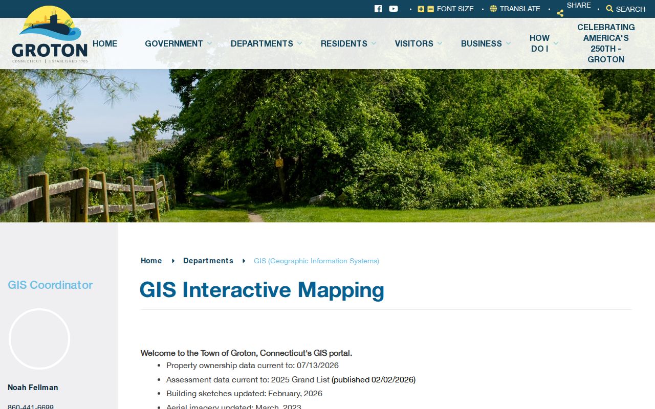
The Groton GIS FAQ and property/deed links show the same search sequence used for the Town parcel viewer.
Use those links as separate evidence points, not as one conclusive map label.
Note: A map result is clickable, but research did not establish parcel-number grammar or a certified boundary.
What Groton Address Points Hold
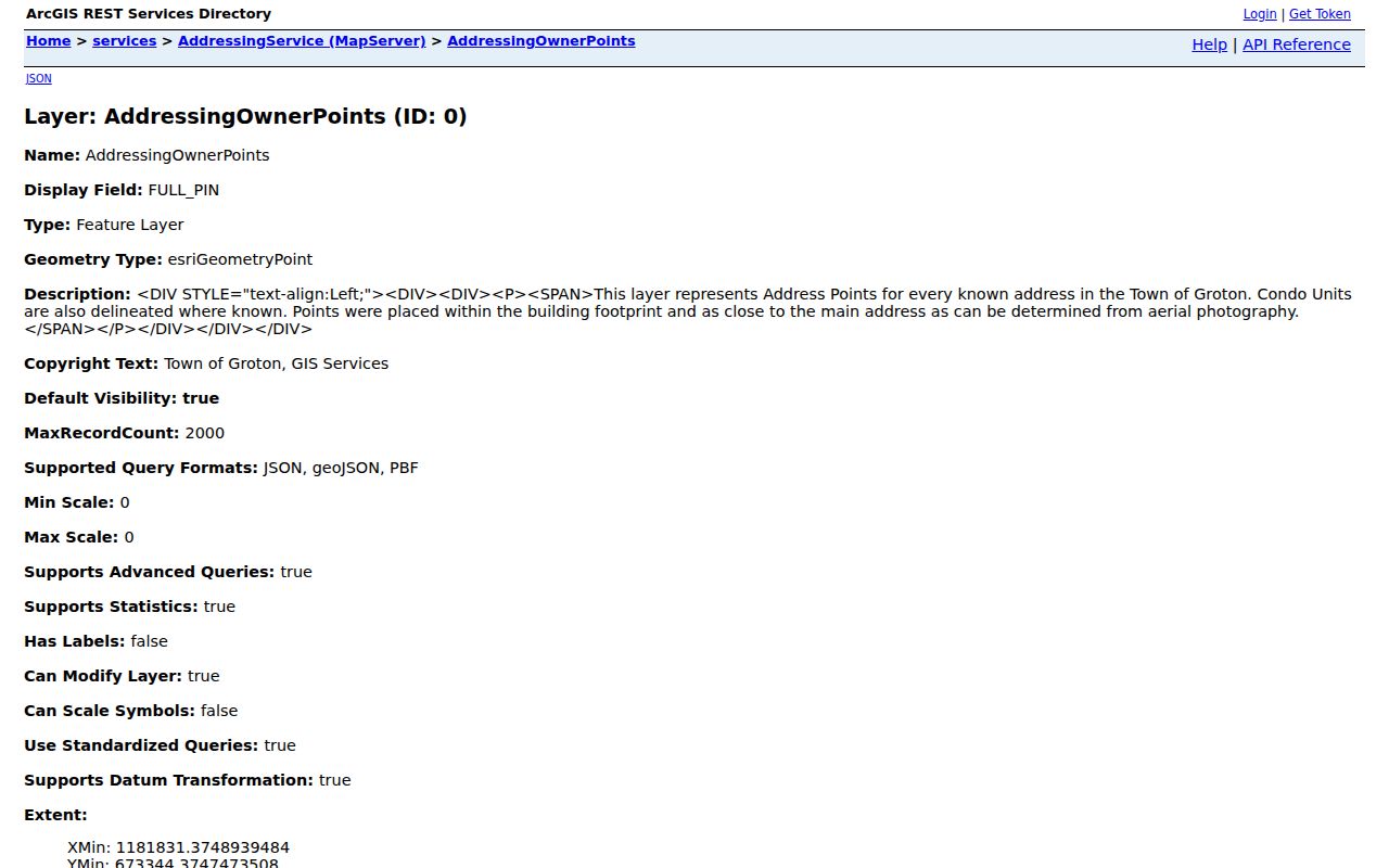
Groton’s AddressingOwnerPoints layer describes known address points, including some condominium units. A point may sit inside or near a building, so it is an address and owner index, not a certified occupancy roster.
The Groton AddressingService owner-points layer displays the field family behind an address-first search.
Read the point with parcel geometry. A condo unit, shared building, or nearby point can change what “at this address” means.
Useful fields include:
PROPERTY_LOCATION,OWN1, andOWN2for location and owner.CAREOF,ADDR1,CITYNAME,STATECODE, andZIP1for mailing.TRIMID,FULL_PIN, and geometry for layer matching.- The link to AddressingParcels and its parcel geometry.
Groton Address Records and Parcels
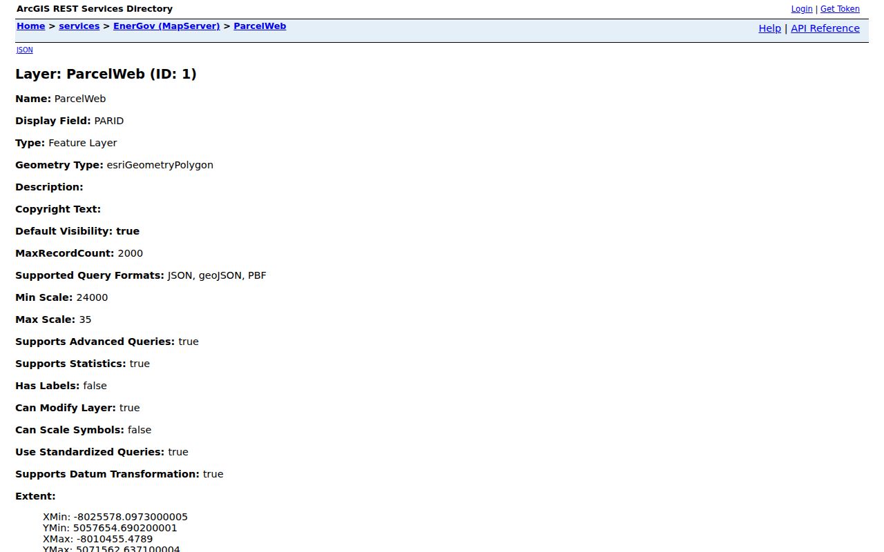
ParcelWeb adds PARID, owner, care-of, mailing, TRIMID, geometry, length, and area. A card adds situs, its physical location, zoning, acres, district, use, deed book/page, building facts, values, sales, picture, and sketch.
Groton sample cards show why those fields stay separate. They display trustees, an individual, an LLC with an Oxford mailing address, and Town open-space ownership. Owner is not automatically occupant, and mailing city is not automatically legal municipality.
The Groton ParcelWeb owner and mailing layer makes the parcel-side relationship visible.
Groton GIS reports ownership current to July 13, 2026. The 2025 Grand List was published February 2, 2026, sketches were updated in February 2026, and listed aerial imagery is from March 2023.
The Assessor office is at 45 Fort Hill Road and lists 860-441-6660, mgardner@groton-ct.gov, and tladia@groton-ct.gov for corrections.
- Parcel
- A mapped assessment unit with an identifier and polygon, not certified title or an exact survey line.
- Situs address
- The physical location on a card. It can differ from mailing address and postal city.
- Plat
- A recorded map or survey reference. A tax map is not a legal description or deed substitute.
- Criss-cross directory
- A dated street-order reference for approaching a number and street, not a current household list.
Groton Street Directory Records
There is no single Groton list that answers every street question. The address key changes meaning at each layer. Use the coverage below to decide which custodian can confirm the next part of the chain.
| Record key | Keeper or layer | Address fields or result | Access and caution |
|---|---|---|---|
Address point, TRIMID / FULL_PIN | Groton AddressingService | Location, owner, care-of, mailing city/state/ZIP, point geometry | GIS layer; not an occupancy roster |
Parcel, PARID or account | Groton GIS and Assessor | Owner, situs, use, building, value, sale line, deed book/page | Viewer and property card; not certified title |
Street segment, SEGMENT_ID | Groton StreetNames | Address ranges, ZIPL/ZIPR, town, fire, status, cross streets | Road context; not a list of occupied numbers |
| Book/page or document date | Groton Town Clerk and RecordHub | Grantor (conveying party), grantee (receiving party), legal description, recording data, image when available | Online window and Town Hall access; verify the instrument |
| Name and municipality | Groton Registrars and Secretary of the State | Official registration or status information when released | Status route; privacy and purpose limits apply |
| Address or parcel in CSS | Groton Planning and EnerGov | Permits, plans, inspections, code cases, requests, and licenses | Records entered after July 2023 may appear; older records may be absent |
Use the point or parcel to reach the card, the card’s book and page to reach the land record, and the street segment only for road and postal context. Keep owner, mailing contact, situs, and occupant as different fields in your notes.
Note: Keep the source role beside each result, because one address can carry different owner, mailing, postal, or legal fields.
Groton Street Segments and ZIP Sides
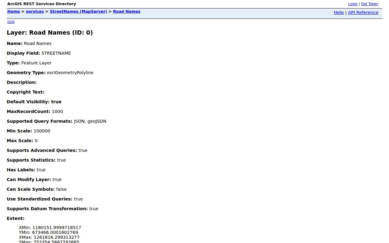
A street is also a set of segments. The Groton StreetNames layer records left and right address ranges, cross-street fields, town names, fire district, ownership, one-way and status values, and ZIPL and ZIPR. A range explains road context. It does not mean that every number is occupied or tied to one owner.
The Groton StreetNames address-range layer helps compare the road segment with the address point and parcel result.
Postal place names add a check. Groton 06340 is the main Town context, 06349 the Naval Base, and 06355 can be a Mystic label on a Groton parcel. West Mystic uses 06388. Test the address through the USPS address lookup, then compare its postal line with GIS and the card municipality.
Save the postal city. Replacing it with a legal town name can hide why a search did not match.
Groton Street Deeds and Proof
Groton has no county deed office. The Town Clerk holds land records, and a card’s book and page is the lead. RecordHub identifies the Groton Connecticut Town Clerk at 45 Fort Hill Road, 860-441-6642, fax 860-441-6703, townclerk@groton-ct.gov.
RecordHub lists July 27, 2021 as the land-record subscription and index start. Its no-subscription route permits most index and image viewing; purchased images remove a watermark. Daily, monthly, six-month, and annual plans appear. Search/Records redirected to login during inspection, leaving exact fields, pagination, export, and free-versus-paid behavior as a live gap.
The Groton RecordHub land-record portal is the online start. The Town Clerk land page says Groton records run online from 1962 to the present and are available in person at Town Hall.
GIS property documentation says deeds before about 1940 are not digitized in its quick-start note, and a deed link can contain a typo or indexing error. Ask about a 1940-1961 gap.
When a portal omits an address record, the Groton Freedom of Information Act (FOIA) request form accepts written office review, printed copies, or USB delivery. It says staff acknowledge within 96 hours and will not create a new analysis.
Note: Keep the date, instrument, book/page, parties, legal description, image status, and retrieval date together.
Groton Address Permits After July 2023
The Assessor describes property data and valuation, but it is not the complete permit archive. Groton’s planning and permit page links to CSS/EnerGov, where the public Search tab can look up permits, plans, inspections, code cases, requests, and licenses. The Map tab can search an address and show permitting history or an option to apply to a parcel.
The Groton planning and permit portal information says account holders can submit and track work, inspections, plans, statuses, and payments. The portal uses an account with email confirmation for those actions, while public search is available without login. Login choices include Google, Apple, Microsoft, and Facebook.
The official FAQ says records entered after July 2023 are in the system and older records may be missing. It also warns about multiple 0 Elm St results, so select the parcel with the correct owner. Live CSS Search and Map field labels did not render during inspection. Do not promise a field order, date filter, export, fee step, or complete older history that the source did not expose.
Groton Street Records Have No County Recorder
New London County is a regional reference, not an operating county government with a recorder for Groton deeds. Connecticut abolished county government as an operating local layer effective October 1, 1960. For a Groton deed, mortgage, lien, map, or trade name, begin with the Town Clerk. A “New London County records” label does not change custody.
The county label still helps elsewhere. Probate PD-30 serves Groton and nearby towns. New London Judicial District uses KNL for Groton civil cases. The Historical Society holds regional genealogies, maps, newspapers, directories, and manuscripts. Different custodians mean a county no-result is not a conclusion about a Groton address.
Save the Groton GIS Search Date
Groton GIS, CAMA assessment data, imagery, sketches, and ownership fields refresh on different clocks. The researched page lists ownership current to July 13, 2026, the 2025 Grand List published February 2, 2026, sketches updated February 2026, and aerial imagery from March 2023. The FAQ separately describes ten-year planimetric captures, latest flight April 2020, and CAMA trailing the Grand List by weeks.
Record the page date, currency date, layer, search term, and retrieval date. If card, GIS, RecordHub, USPS, and CSS disagree, name the conflict instead of choosing silently.
The Groton ArcGIS REST services directory, a machine-readable layer catalog exposes Query, Find, Identify, and Export operations. Inspected layers support filtering and pagination, with a 2,000-record maximum on those layers. A technical query is not permission to publish a bulk owner extract.
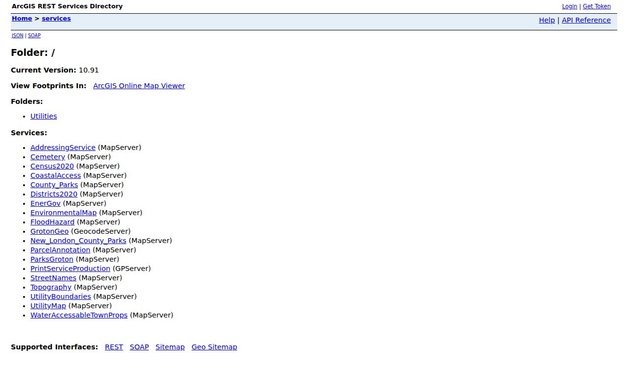
Keep the layer, filter, geometry, date, limit, and owner fields with research notes. GIS contact: Noah Fellman, 860-441-6699, it_helpdesk@groton-ct.gov. Assessment corrections go to 860-441-6660.
Groton Voter Records by Address
Voter information adds status context, not a list of everyone at an address. Groton Registrars are at 61 Fort Hill Road, Community Center, 860-441-6650. Posted hours are Thursday-Friday 8:30-4, Tuesday 5-7, with appointments as needed.
The Secretary of the State (SOTS) centralized registry is the official statewide list, with registration and election participation information. Public Act 26-1 §96 makes month and day of birth exempt while the year remains public. The direct SOTS lookup was firewall-blocked, so hidden fields and result columns are not inferred.
The Groton registrars and voter-record guidance supports three distinct access routes:
- Ask the Groton registrars about registration, corrections, or an allowed local inspection, subject to identity and privacy rules.
- Use the SOTS individual lookup linked in the local voter information, then save the exact spelling, municipality, status, and retrieval date.
- Request the statewide CSV through the SOTS voter-file form. The researched form lists a $300 fee, prepayment, and certification for election-related, scholarly, journalistic, political, or governmental use.
The full-file route is not a public street list. Its form bars personal, private, and commercial use, advertising, marketing, sale, and harassment. A protected or absent result may reflect a privacy program rather than nonregistration.
Note: Save search spelling and date; municipal updates and protected records can change the registry result.
Limits of the Groton Street Directory
Address records describe fields, not a complete household. An owner may use a mailing address elsewhere. A parcel may represent a trustee, an LLC, public open space, or a shared building. A map buffer may show nearby polygons, but roads, water, easements, condominium layouts, and irregular parcels can change adjacency. A GIS result is not a certified abutter list.
Some residential addresses are protected under Connecticut privacy rules, including covered officials and people who qualify for voter-address protection. DMV address information is constrained by federal law, and utility or delivery customer records are not part of the public street chain. Verify a record with the custodian and keep a missing result separate from a negative conclusion.
Privacy and lawful use. Groton address records are for lawful personal research, family history, reconnecting, and civic curiosity. Do not use a street search to stalk, harass, intimidate, or harm anyone. A public field still requires care.
A careful by-address search ends when the source has answered its own question. It does not turn owner data into an occupant claim, a road range into a resident list, or a technical query into permission to publish personal details.