
Groton ZIP Codes by Place
Postal ZIPs are delivery labels. Groton, its City subdivision, and New London County are separate record layers. The official Connecticut post-office list identifies 06340 and 06349. Station labels sort mail, but do not decide which clerk holds a deed or assessment. These are the four supported Groton contexts. No official source tied 06357 to a Groton parcel, so it is not listed. Keep USPS and parcel results side by side.
| ZIP Code | Areas Covered | Post Office | Notes |
|---|---|---|---|
| 06340 | Groton, Borough, Groton Long Point, and Noank context | Groton station, 100 Plaza Court; nearby station listings | Most Town and City addresses use this context, but station names are not legal jurisdiction. |
| 06349 | Groton Naval Base / Submarine Base | Naval Base station, 1 Naval Submarine Base | Distinct federal-installation context, not a general residential Town boundary. |
| 06355 | Mystic postal place, including parcels that require a municipal check | Mystic station context | Mystic straddles Groton and Stonington; test the address in GIS. |
| 06388 | West Mystic place context | West Mystic station context | Do not assign Stonington or Groton without the address-level parcel result. |
The table is a routing aid, not a resident roll. USPS shows station context; the Assessor and Town Clerk answer land questions. The USPS Groton station page provides a visual reference for the main 06340 postal context, not a municipal boundary file.
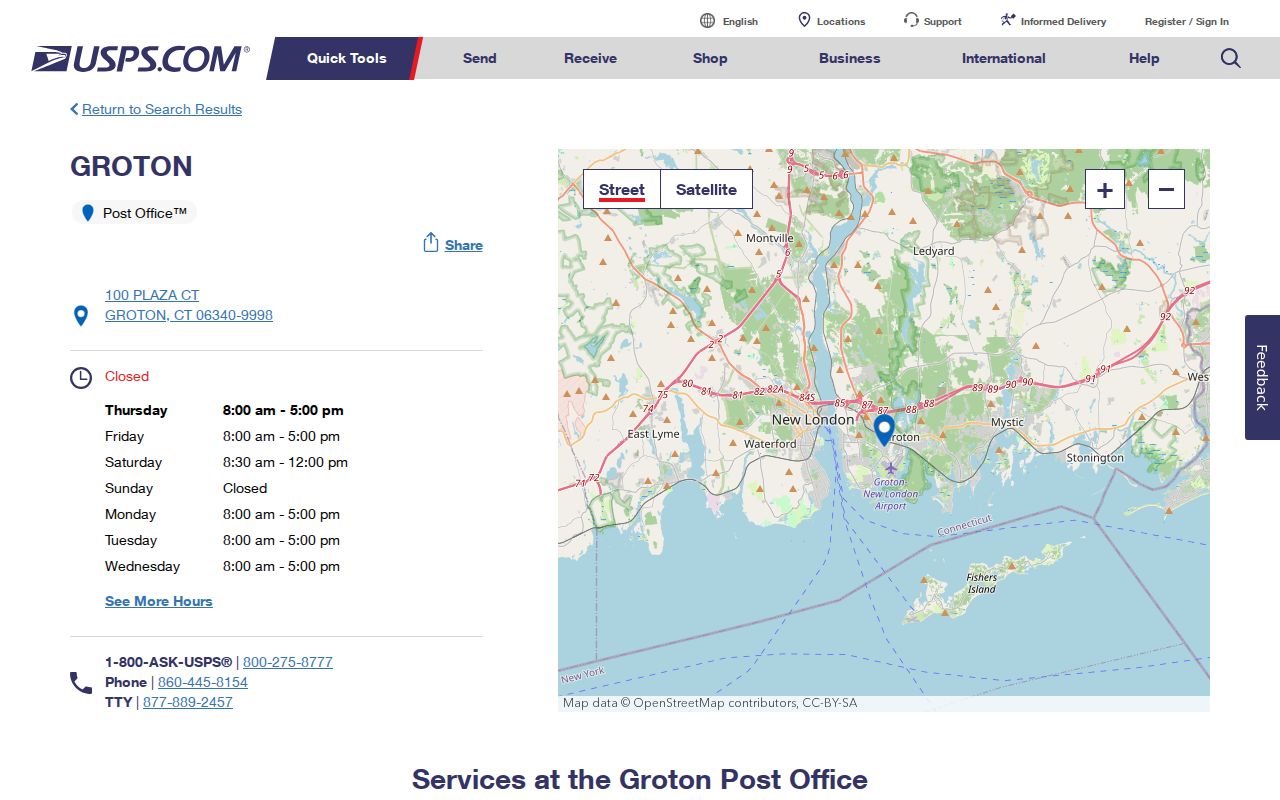
The map gives orientation. USPS address lookup confirms a delivery point. The Connecticut post-office list supplies state context.
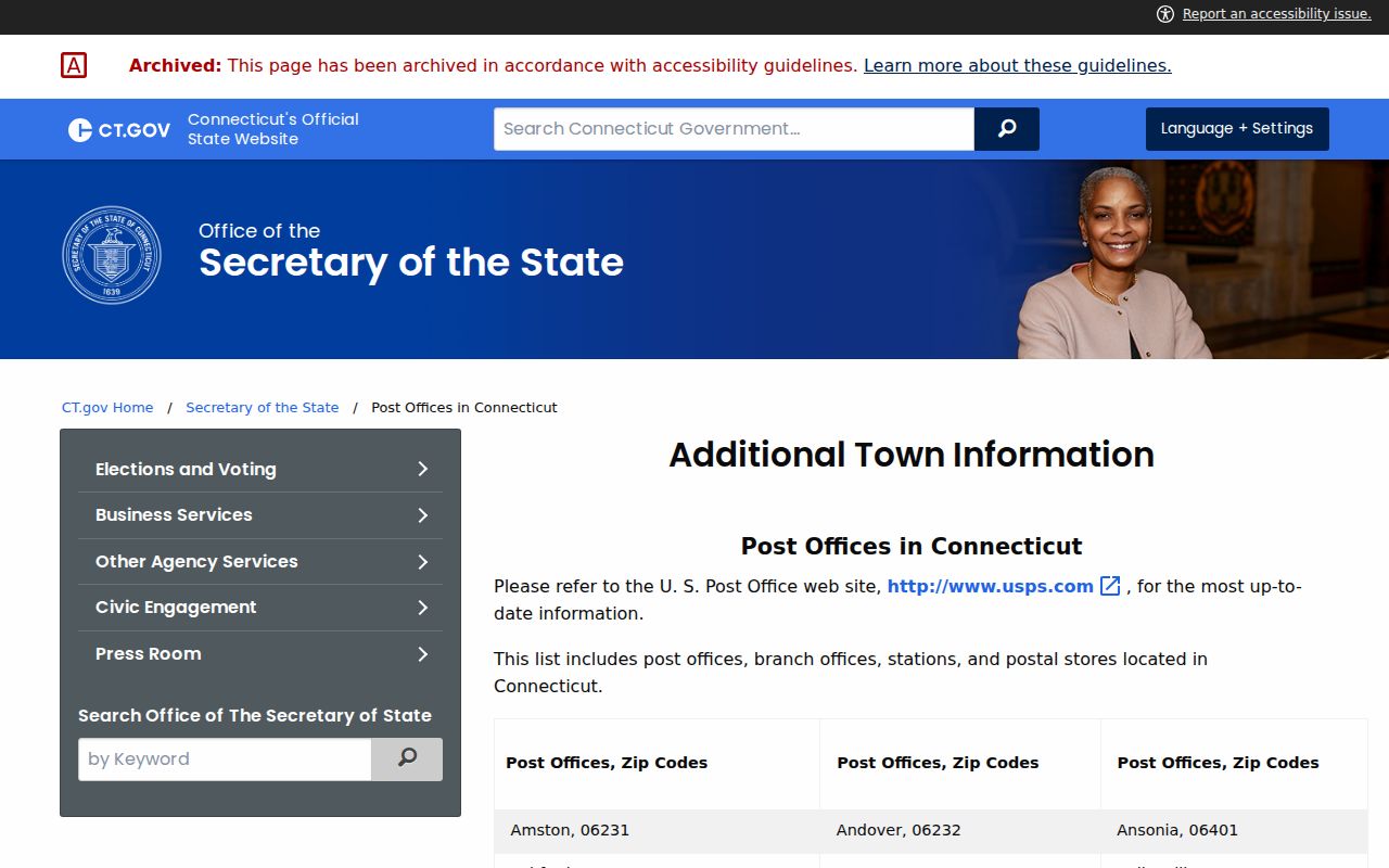
The state list gives context; USPS confirms the delivery point.
Groton 06340 Places and Stations
06340 is the broadest local postal context in the research. USPS lists the main station at 100 Plaza Court, plus Borough, Groton Long Point, and Noank references. They are place labels, not separate municipalities or land custodians.
Town land, vital, voter, and assessment systems can cover a postal local place. The City has its own clerk and archive, but 06340 alone does not choose that custodian.
An image of the USPS Groton Long Point station preserves the station's place-name context and its 06340 line.
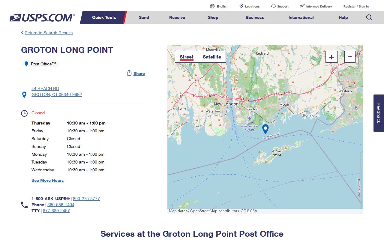
The station reference shows why a local place can appear in postal data without becoming a separate municipality or Town Clerk series.
Groton 06349 Is Installation Geography
06349 is the Naval Base and Submarine Base context. The USPS Naval Base station page lists 1 Naval Submarine Base, Groton, CT 06349-9992. It is a federal-installation postal reference, not a second town, general neighborhood ZIP, or proof of a residential Town parcel.
Preserve the postal line, then ask whether the question concerns mail, the installation, a Groton parcel, or a Town record. GIS and Town Clerk tools answer land questions; a missing parcel result does not identify a missing person.
Insider tip. Treat 06349 as special postal geography, then check the record's subject. A ZIP narrows geography; it does not certify a person's legal relationship to an address.
The USPS Naval Base station page gives the exact installation context behind 06349.
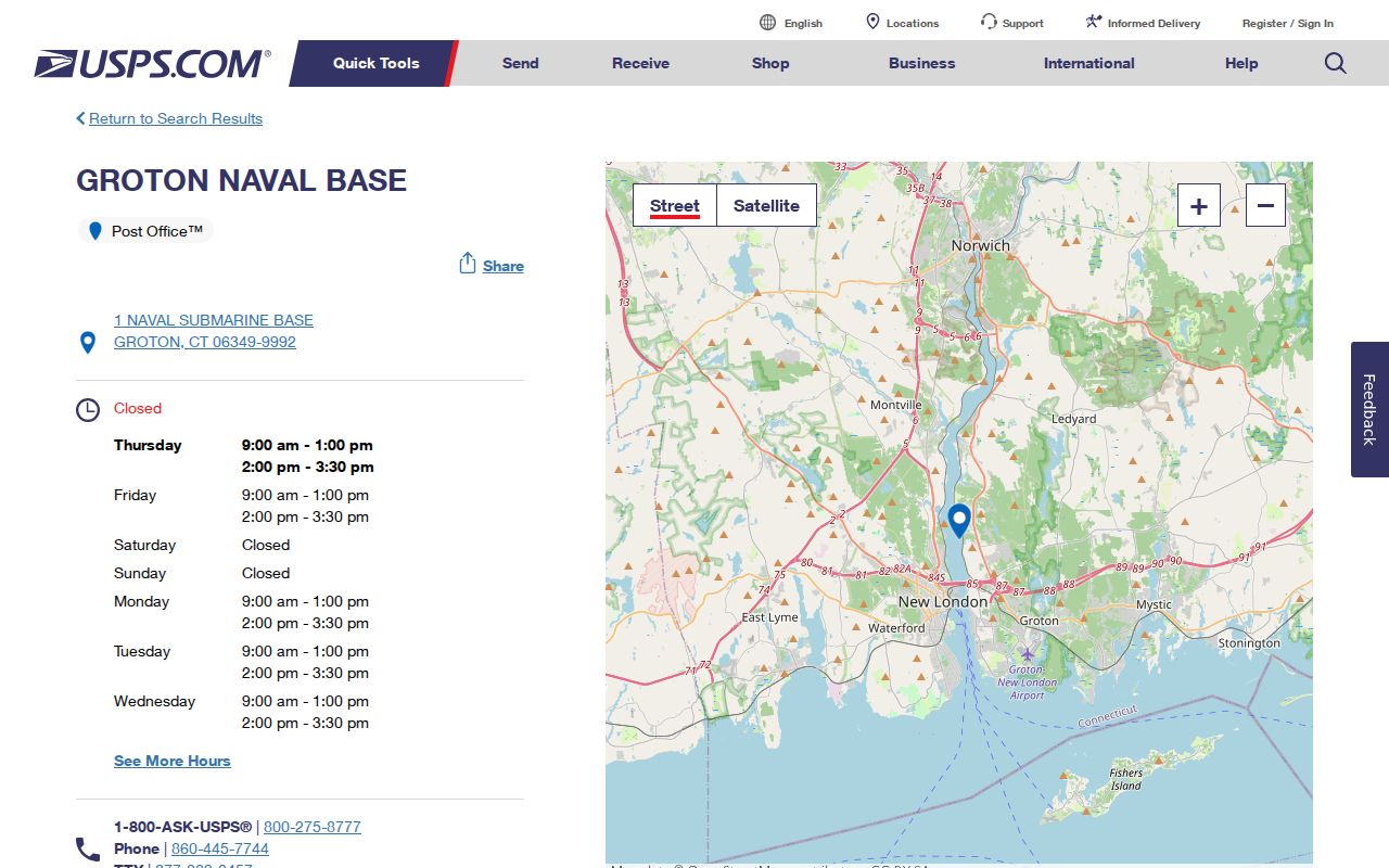
Use the station page for postal orientation, then choose the custodian tied to the question rather than the ZIP alone.
Groton 06355 and 06388 Checks
06355 shows how a postal city can cross a legal context. Mystic straddles Groton and Stonington, and the Groton card for 11 Avon Place displays Mystic, CT 06355 while identifying a Groton parcel. Test each address in the municipal parcel system.
06388 carries a West Mystic label. No USPS boundary shapefile was captured, so the station context cannot assign a parcel to Stonington or Groton. Run the address through USPS, compare it with the GIS point and card, and preserve a historical source's original place name.
For a ZIP code directory, a place name is a question to verify. The assessor card supplies situs, parcel, owner or mailing fields, and deed book and page, but the owner field is not proof of residence.
Groton ZIP Lookup Fields
The official USPS address-to-ZIP lookup is the first test when a postal line is uncertain. It asks for a street address and provides city, state, and ZIP context, with fields for a company, unit, city, state, and ZIP. Save the result with its date and exact spelling.
The captured form is a planning aid, not a promise that fields stay the same. Street address is marked required; the others support the address or provide a check.
The USPS ZIP Code by Address form shows the inputs to preserve before comparing a result with Groton records.
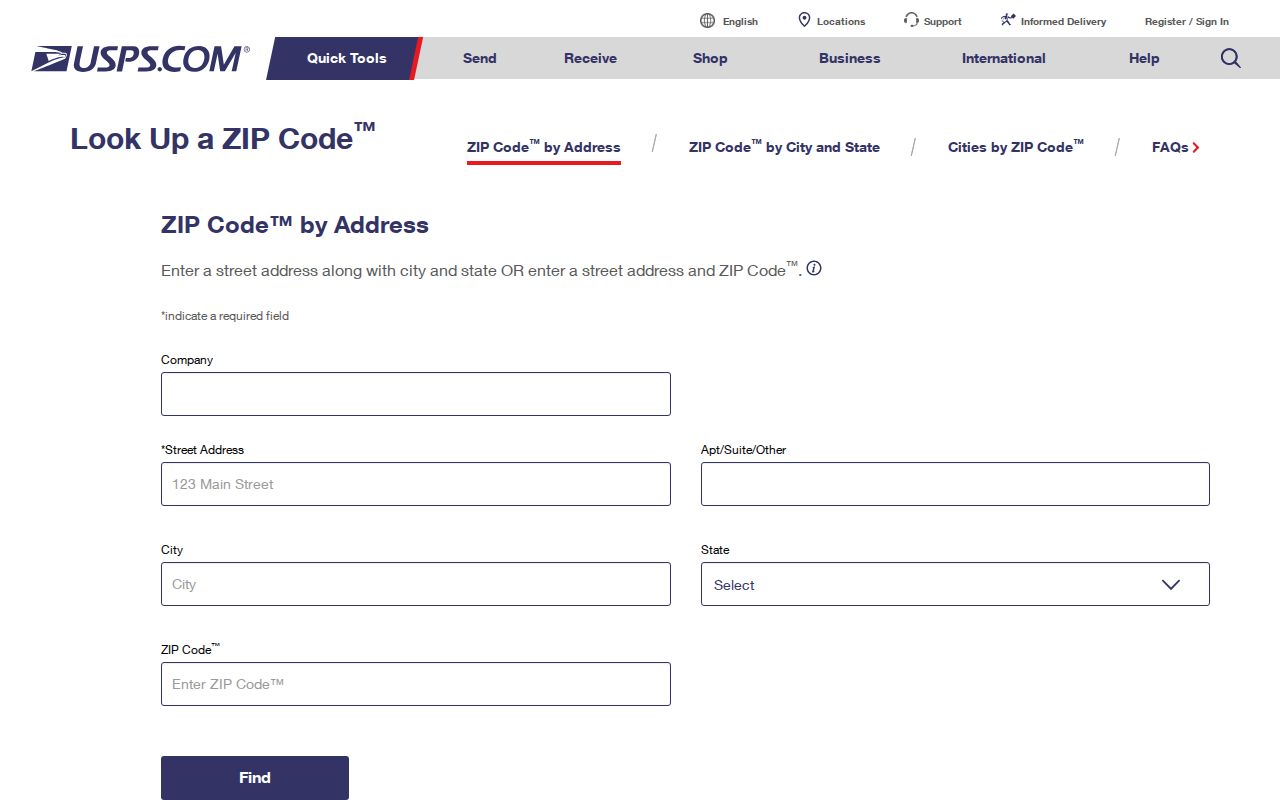
It validates a mailing address, not an owner, parcel boundary, voter status, or resident list.
| Field | Form status | Use in a Groton ZIP check |
|---|---|---|
| Company | Not marked required in the captured form | Retain a company line when it is part of the mailing address. |
| Street Address | Marked required | Enter the complete street number and street name. |
| Apt/Suite/Other | Additional address detail | Preserve a unit or other delivery detail when supplied. |
| City | Postal-place input | Keep the original city or place label instead of correcting it by guesswork. |
| State | State selection | Choose Connecticut for a Groton-area address. |
| ZIP Code | Available for an address-plus-ZIP check | Compare the supplied ZIP with the returned postal result. |
Finding Residents Inside a Groton ZIP
A ZIP is a starting filter only when the record stores postal fields. Groton GIS exposes address and owner or mailing fields, while StreetNames includes ZIPL and ZIPR for road sides. Its documented searches are Owner Name, Address, Street, Parcel ID, and Parcel ID by Parcel Boundary, so do not assume a universal ZIP search mode.
For lawful personal research, keep the chain narrow and record each result before moving to the next custodian:
- Keep the original postal city and ZIP exactly as typed, including an unusual place name.
- Run the address through USPS and save the returned city and ZIP with the date.
- Open the Groton GIS Viewer, search by address or street, and open the matching point or parcel.
- Compare municipality or district, situs, owner or mailing fields, and postal city without treating one field as residence proof.
- Inspect StreetNames when a road crosses a place or ZIP context, including ZIPL, ZIPR, TOWN_NAME, and cross streets.
- For land, verify deed book and page with the Groton Town Clerk and RecordHub. Online records start at 1962; the GIS quick start warns that deeds before about 1940 may not be digitized.
- For history, preserve the source's original place convention and date rather than replacing it with today's ZIP.
Once a ZIP narrows candidates, the Groton street directory by address can take over. Locate the right record, not a ZIP-wide name file.
Groton ZIP Segments in StreetNames
The GIS StreetNames layer adds detail hidden by a postal-city label. It records ZIPL and ZIPR, TOWN_NAME, cross streets, address ranges, fire district, ownership, status, and one-way information. A road can change ZIP or place context across a segment. These are road attributes, not proof that every number is occupied.
Use the official StreetNames service with the Groton GIS department, then open the address point or parcel. If a value conflicts with USPS, preserve the conflict and ask whether it is a delivery label, parcel refresh, segment boundary, or address issue.
Insider check. Compare ZIPL and ZIPR before treating a road as one postal area. The map locates a segment; USPS confirms the delivery address.
Groton ZIP Lines Are Not Town Lines
A Groton address can mean a Town parcel, City context, postal city, district, or federal installation. New London County is geographic and judicial context, not the land-record office. The Town Clerk holds land, map, survey, trade-name, vital, and military-discharge records. Online records start at 1962; ask about coverage from 1940 through 1961.
A ZIP code directory is most useful when it shows the hierarchy. These definitions are general terms, not a claim that Groton has a PO-box-only or unique ZIP without official support.
- ZIP code
- A five-digit USPS delivery label. It is not a municipal boundary or resident list.
- ZIP+4
- Four extra digits that identify a more specific delivery segment.
- PO-box ZIP
- A ZIP used for PO Box delivery at a station, not automatically for the surrounding residential area.
- Unique ZIP
- A ZIP used for one large organization or installation. Research describes 06349 as a distinct federal-installation context without assigning a broader class.
- Carrier route
- An internal delivery grouping within a ZIP, not a public household list or parcel layer.
Lawful personal use. Postal, parcel, and public-record clues may support family history, address correction, or civic research. Do not use a ZIP-based search to stalk, harass, intimidate, or expose a protected address.
Groton ZIP Geography in Layers
One address can hold several labels at once. The hierarchy below points each question to the authority that can answer it.
Start with the most specific layer available. USPS supplies delivery geography, GIS supplies parcel and situs clues, and regional context belongs only with the record type that needs it.
| Level | Example in Groton research | Authoritative check |
|---|---|---|
| Street or segment | StreetNames route, left/right range, and cross street | Groton StreetNames layer and GIS Viewer |
| Situs or place label | Groton, Mystic, Noank, or Groton Long Point | GIS address point or property card |
| Legal municipality | Town of Groton or City subdivision | Town or City jurisdiction pages and parcel custodian |
| Postal city and ZIP | Groton 06340, Naval Base 06349, Mystic 06355, or West Mystic 06388 | USPS address lookup or station data |
| Statistical geography | Census block or block group | Groton Census2020 service or U.S. Census |
| Regional context | New London County or New London Judicial District | Court, historical, or regional source metadata |
That stack explains a Mystic postal address on a Groton parcel, a 06349 installation line, and why a Census block is not a named household list.
Groton Population Is Not a ZIP Count
The Census QuickFacts Groton table shows approximately 38,762 for 2024 and 39,138 for 2025, with a 2020 base around 38,392 or 38,397. Those are Town-level figures, not residents served by one postal route. Town material gives 2010 population 40,115 and incorporation in 1705, but neither assigns a ZIP.
The Census2020 GIS service adds block and block-group boundaries for comparison. Census geography is anonymous. It can show scale, but not a named neighbor list or a person's link to a parcel. Keep it separate from USPS coverage and assessor owner fields.
Live Groton ZIP Searches Need Rechecking
USPS pages, address lookup, Groton GIS, assessor cards, and RecordHub are live or refreshed systems. The research captured a point in time, not a permanent boundary. GIS dates ownership to July 13, 2026, the 2025 Grand List to February 2, 2026, sketches to February 2026, and imagery to March 2023. Its help material separately identifies April 2020 as the latest planimetric flight, so the dates belong to different layers.
RecordHub can show free index and image viewing while print or download plans, subscriptions, or login gates affect the next step. Its public search route redirected to login, so exact grantor and grantee filters were not inferred. If a result is missing, check the Town Clerk page, ask about the relevant book, index, or image range, and retain the date. No USPS boundary shapefile was captured, so add no extra Groton ZIP claim without address validation.
Note: A captured station or form is a point-in-time reference; rerun USPS and GIS checks as routes and data vintages change.